Having been blessed with the chance, and the health, to walk up Mount Snowdon and Scafell Pike several years ago, NSB has long wanted to make it to the top of Ben Nevis, the third of the "Three Peaks". The chance came around recently on a trip to Scotland, and NSB was doubly blessed by very good (i.e. clear) weather. Below are some pictures but, before that, lets have a look at how Ben Nevis was formed.
Ben Nevis is the tallest mountain in the UK, at 1344m, and is located next to Fort William in the Scottish Highlands.
The mountains in this area were formed some 400 million years ago during the Caledonian Orogeny. At this time the Iapetus ocean was closed by the collision of the continents of Avalonia, Laurentia and Baltica. The images below from the BGS show how the upper and lower parts of the UK mainland were joined together during this process. As the ocean closed, there was a great deal of volcanic activity at the subduction zones at the ocean edges. This volcanic activity (which is similar to the volcanic activity on the western seaboard of South America currently) is what gave rise to the volcanic rocks in the Lake District and the Highlands of Scotland.
Also here is a nice video explaining how Ben Nevis was formed (suggest skipping the first minute or so though).
The so-called "suture" line can actually be seen in the Isle of Man, as shown below.
The rocks at top and left formed in Laurentia (which contained Scotland) but the rocks at lower right formed in Avalonia (which contained England).
Also well worth reading this vividly written BBC article on the volcanic history of the UK
Since its formation, Ben Nevis has been eroded down very significantly, as shown below - walking to the peak is now a journey through the interior of a volcano!
Much of that erosion was caused by glaciers during past ice ages, when the Ben Nevis range might have looked something like this image from Greenland.
With that introduction out of the way, here are a few pictures of the walk up to the Ben Nevis peak.
The top part of Ben Nevis is a "blockfield" of angular broken rocks. This is believed to have formed during the last iceage when the majority of the mountain was covered in a glacier leaving the exposed top vulnerable to erosion by freeze-thaw action.
Image Sources
All NSB own except Isle of Man, Greenland , Iapetus, Schematic
Royal Geographical Society (with the Institute of British Geographers) (schematic)
Ben Nevis is the tallest mountain in the UK, at 1344m, and is located next to Fort William in the Scottish Highlands.
The mountains in this area were formed some 400 million years ago during the Caledonian Orogeny. At this time the Iapetus ocean was closed by the collision of the continents of Avalonia, Laurentia and Baltica. The images below from the BGS show how the upper and lower parts of the UK mainland were joined together during this process. As the ocean closed, there was a great deal of volcanic activity at the subduction zones at the ocean edges. This volcanic activity (which is similar to the volcanic activity on the western seaboard of South America currently) is what gave rise to the volcanic rocks in the Lake District and the Highlands of Scotland.
 |
 |
Also here is a nice video explaining how Ben Nevis was formed (suggest skipping the first minute or so though).
The so-called "suture" line can actually be seen in the Isle of Man, as shown below.
 |
| Standing on two different tectonic plates |
The rocks at top and left formed in Laurentia (which contained Scotland) but the rocks at lower right formed in Avalonia (which contained England).
Also well worth reading this vividly written BBC article on the volcanic history of the UK
Since its formation, Ben Nevis has been eroded down very significantly, as shown below - walking to the peak is now a journey through the interior of a volcano!
 |
| Schematic showing how Ben Nevis formed and was then eroded to it's current shape Copyright Royal Geographical Society |
Much of that erosion was caused by glaciers during past ice ages, when the Ben Nevis range might have looked something like this image from Greenland.
 |
| During the Ice Age, the Ben Nevis area might have looked something like this |
With that introduction out of the way, here are a few pictures of the walk up to the Ben Nevis peak.
 |
| Starting out, 100-200m up, looking along Glen Nevis |
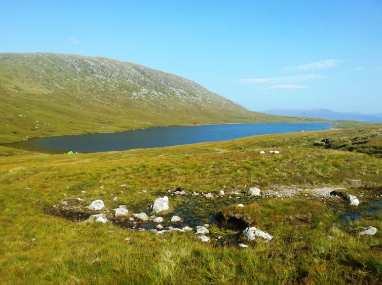 |
| By Lochan Meall an t-Suidhe - the "Half Way Lake" about 580m up |
 |
| Looking back at the lake from about 900m up. |
The top part of Ben Nevis is a "blockfield" of angular broken rocks. This is believed to have formed during the last iceage when the majority of the mountain was covered in a glacier leaving the exposed top vulnerable to erosion by freeze-thaw action.
 |
| At around 1200m and no, that isn't the top. |
 |
| View north just before reaching the top, sheer drops if you drift off course in fog |
 |
| Incredible view from the top 1340m |
Image Sources
All NSB own except Isle of Man, Greenland , Iapetus, Schematic
Royal Geographical Society (with the Institute of British Geographers) (schematic)